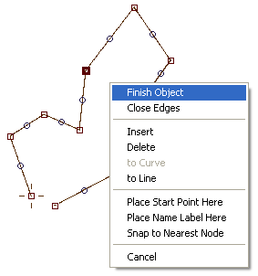
Edit Mode Pop-Up Menu
Click right mouse button in creation/edit mode on the work area to access this pop-up menu.

Finish Object ends the creation/edit mode. If object is polygon (area), program automatically closes the object.
Close Edges closes the object. Use it for land and depth contour lines to ensure that line is closed.
Split Object. This command is available only for polyline objects. Select square node (end of curve or straight line element) and use this command to split the object.
Insert, Delete, to Curve and to Line commands are available only if rectangular node is selected (end of curve or straight line element). Insert creates a new element before the selected element. Delete erases selected element. To Curve converts selected straight line element into curve. To Line converts selected curve element to straight line.
Use Place Start Point Here command to change beginning of the object. This command is available only if rectangular node is selected (end of curve or straight line element).
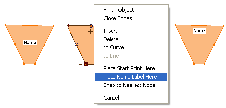
Mapwel software automatically places the name label of Area object. If you want to assign position of label manually, use the Place Name Label Here command. The label center is positioned on a place where the mouse cursor was before you invoke this pop-up menu (small cross on the below picture). Note: Label position is valid only in the Mapwel software. It is not transferred into the GPS. GPS decides where to display name labels by itself.

Snap to Nearest Node moves selected node to nearest node which belongs to other object (not to currently edited object).