Multiple Background Areas
When compiling map and uploading it to GPS, user may encounter an error message 'Error: Map contains several objects of "Background Area" type! There should be only one area of this type in the map.'. This situation needs fix in the map, otherwise map may be fully or partially invisible (in the GPS). Unlike other polygon types (land, playground, lake, etc. ...), the background area polygon cannot be used freely in the map. Its purpose is strictly limited to define shape of the map, if map is of irregular shape. If map is of rectangular shape, the background area polygon is not needed. Multiple background areas appear most often in the map because of two reasons:
-
Map is created by merging multiple tiles (each with its own background area polygon) together
-
Improper use of background area type for objects like buildings, parking areas, etc.
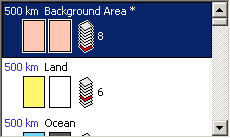
Mapwel software displays list of map objects in the inspector window at the right side panel. Background areas have red icon to draw attention of the user (below picture).
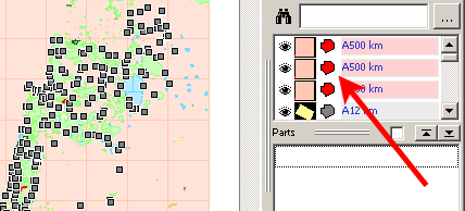
Background area objects have red icons on the list. In the map, they appear in default pink color.
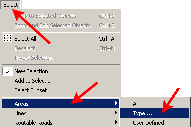
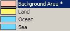
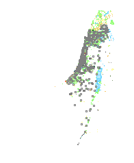
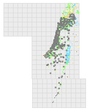
Map on above picture contains hundreds of background area polygons that need to be fixed. To select them all at once, use the main menu > Select > Area > Type ... command. Click "Background Area" type.
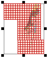
Selection of all background area polygons at once.
Now there are 2 ways how to handle selected polygons. The first one is to delete them. Hit delete key or use main menu > Edit > Delete command.
Map after erasure of selected background area polygons
The second way is to re-type (convert) selected polygons to other type. Click right mouse button to invoke a pop-up menu. Select Properties command.
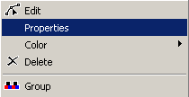
Select Properties to open the Properties window.
Selected objects are of background area type. Select a new type from the list.
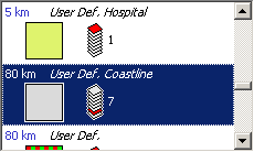
Selected objects changed to "User Def. Coastline" type. Polygons on the map change color from pink (background area) to gray (coastline).
Now map can be saved and compiled for upload to the Garmin GPS unit.